Dana, continued...
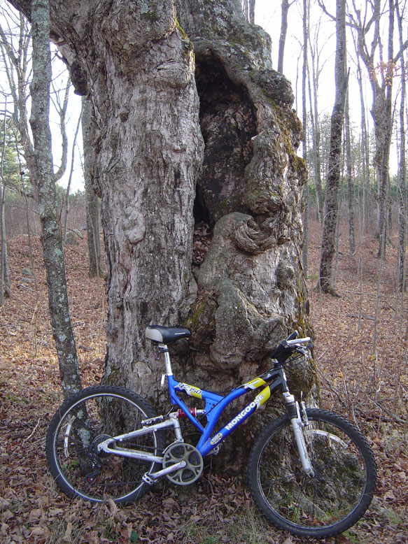
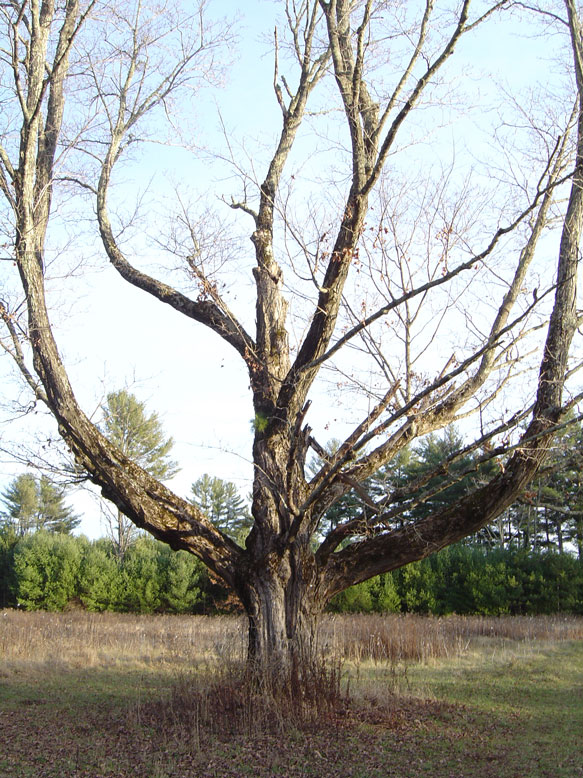
I spent some time here at Graves Landing admiring the landscape. I attempted to find where on the opposite shore the road came out, if at all, but I could not find it. The wind started to whip up again, and with a windchill of about 23 degrees I was not looking forward to riding up the big hill I just came down to get back to the common. With my back to the water, I started back. At the common I took some more pictures of the area. Some nice pano shots, and some shots of trees that are much older than I. Perhaps they are even older than the town of Dana itself was. A Nipmuck may have passed through here when these grand trees were only saplings. All color imagery is clickable for a higher-res view.
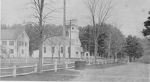
A shot from the south side of the common, looking to the northeast. You would have seen the Town Hall and school from here.
The town hall (right) and school (left) as viewed by almost the exact same angle I took the above photo at. It was just taken farther up the road to the east (right in the color photo). I did not know of the existance of the black and white pics when I was photographing the place so it is just chance I took a pic from the same angle. Perhaps I have a photographer's eye and just recognized, as did the original artist, that this was just a great angle. If you look at the black and white, check out the right side of the photo closely. See the two trees right next to each other, then a third just a bit farther to the right...next to the road? Now check out the color photo...to the right. The two leaveless trees and then another tree just a bit farther to the right? Same angle, eh?
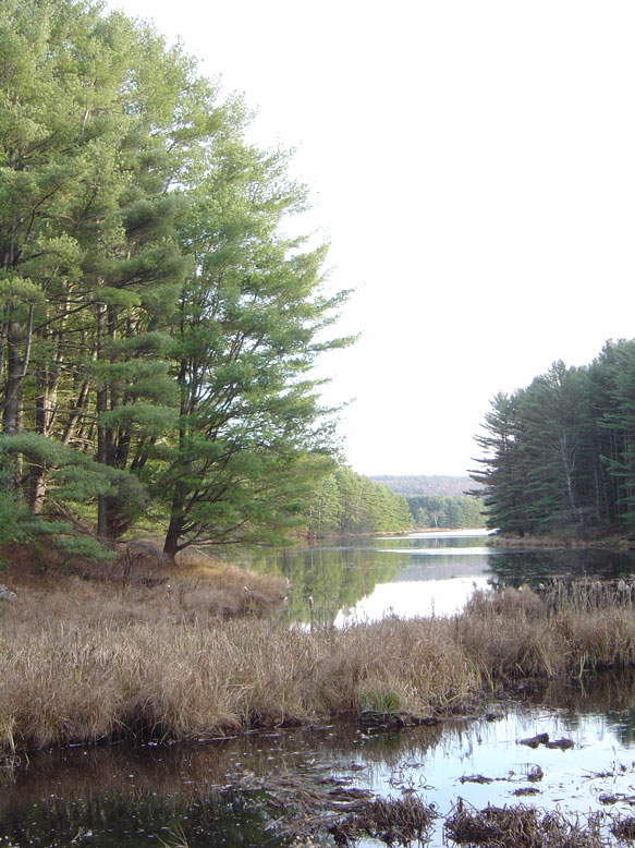
A little farther down the road we come across Pottapaug Pond. It was much smaller in the days of Dana. When the dams were created to make Quabbin the pond of course 'backed up' a bit as its waters could not escape. I used to fish in Pottapaug Pond by renting a boat with my friends and heading out in the wee hour of the morning. I did go there with my Dad once too, but we got turned away by a thunderstorm coming in.
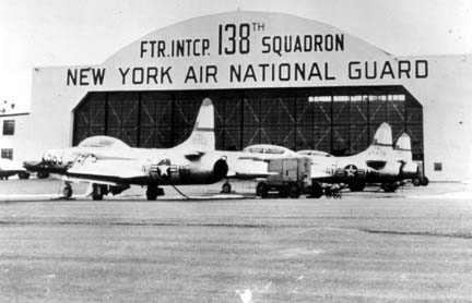
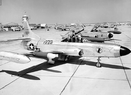
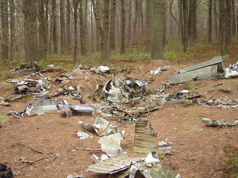
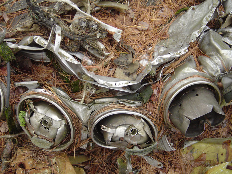
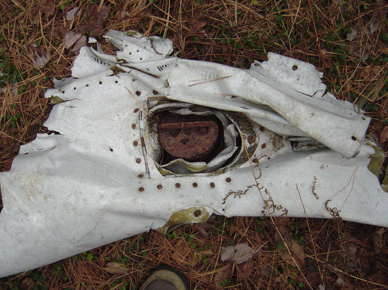
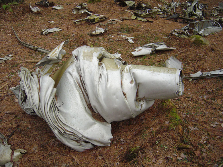
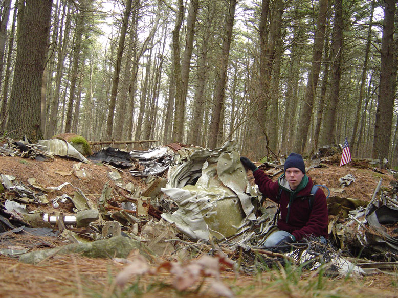
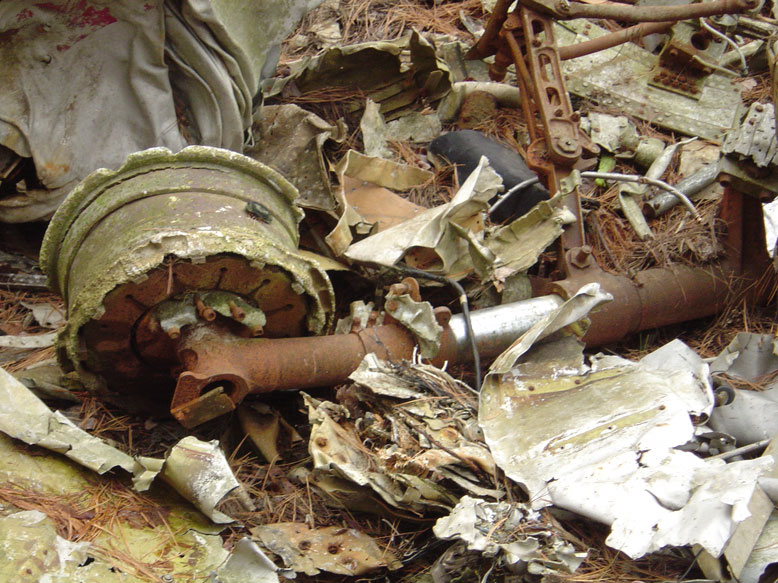
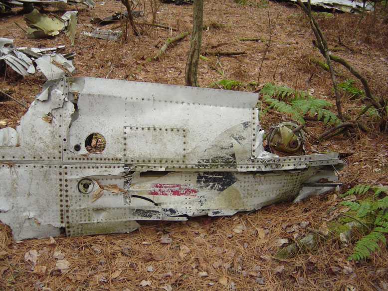
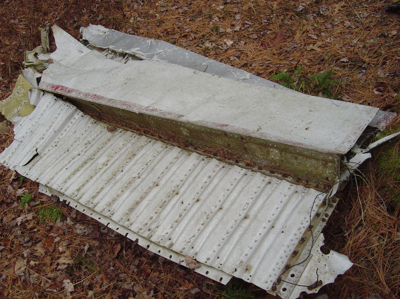
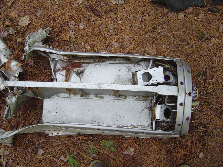
The F-94B Starfighter Crash It is April 3rd, 1955. A Noreaster is pounding Massachusetts. The wind howls yet not much snow falls. In central New England about 30 inches falls, and in the Berkshires they also get pounded. But here, only a few inches. Power lines and communication lines (telegraph) were down all over New England. Route 2, the Mohawk Trail, is also closed. The main concern of the pilot was the wind. He was flying above the storm, trying to use radio location to find out his exact posistion. Back in the day, planes could only be identified on radar by the radar operator asking the pilot to fly a particular maneuver. When the corresponding dot on his radar screen did the same thing, well then he knew which plane he was talking to. He would have used his nav radio, but that had gone out. What an unlucky day. He had a rough idea where he was. Somewhere around Quabbin. This was not a good thing, as the radio op had him doing ID turns at 1000 feet. The hills in the Quabbin area rise to about 1300 feet. You do the math. He did the math, and he didn't like the answer. Late afternoon was coming around and he only had 20 gallons of fuel left. That equated to about 2 minutes of flying time before flame-out, and the radar op still couldn't confirm which plane was his. Situation? Not good! He thought he would slow the plane down by lowering the landing gear and the flaps. Check. A few seconds later the plane started to shake. Again, not good. The plane was losing lift, he's running out of fuel. The pilot releases the canopy, pulls the eject handle, and is unceremoniously spat out into the cold, cloudy, snowy, wind-whipped atmosphere. He waits for it...he knows he's around Quabbin. For sure he will be landing on the thinning Quabbin icepack. Instead, he hears his plane crash into something. The ice, most likely. Then, solid ground. He made it! He later learned that he landed on Prescott Peninsula. What happened to his plane, he did not know. Subsequent searches turned up nothing, and it was assumed it had sunk into the very deep waters of Quabbin Reservoir. 45 Years later he stands there in his leather jacket, caterpiller pin (denoting an ejection), and looks at the wreckage. It had been found in the woods by loggers many years ago but nobody knew exactly what it was or where it came from. He did. It was his plane. He stood there and touched it, reliving the experience. The plane's mostly aluminum body did not have much in the way of rust on it, but the imact had shredded the thing like cheese through a grater. A deep hole marked the impact site. While he was standing there, a ranger which they had previously run into and exchanged information with came up with a pilot's helmet. It had been found on an island in the 60s'. He looks at it, but is not his. Apparently someone else's plane had met the same fate. (I have not been able to turn up any records whatsoever of a crash, apparently they want to keep it hush-hush). This was a nice bit of closure for him. The pilot reportedly passed away before the 50th anniversary of the crash. He had planned to visit again, but he was called before he could. I took some pictures: Reference pics of an F-94B Starfighter
Below, an F-94A. They look just about the same as a F-94B Each of the below pics are clickable for full-size imagery.
Well, I hope you enjoyed this tour of these roads back into history. Share with your friends.
Take me back to www.skinut.net
|
|---|